
Site NWS31 compared to the other sites within the Sheffield Plan: Proposed Additional Site Allocations May 2025 (PASA) is modest in scale—yet raises disproportionately complex planning, heritage, access and ecological issues. The overall housing shortfall has been largely addressed through other sites, and removal of NWS31 would not materially compromise delivery of strategic objectives and would improve the environmental sustainability profile of the plan overall.
Undue harm to Heritage Asset
NWS31 is explicitly identified in the Heritage Impact Assessment as impacting heritage assets (PASA, Page 26). Paragraphs 202–221 of the National Planning Policy Framework, Dec 2024 (NPPF) require clear and convincing justification for any harm to heritage significance. There is no indication in the site proposal that such harm has been justified or that less harmful alternatives have been properly explored in this regard. The precautionary principle should apply, and the site removed until robust evidence is provided.
Protection of Best and Most Versatile Agricultural Land
There is strong reason to believe that site NWS31 comprises land that is, or has been, in agricultural use and may qualify as Best and Most Versatile (BMV) land under the Agricultural Land Classification (ALC) system. The site is contiguous with actively farmed fields, shares the same landscape context and topographical profile, and is bounded by traditional hedgerows that indicate long-established field systems. NWS31 itself presents as open grassland, showing no evidence of prior industrial or urban use, and appears consistent with pastoral or meadow land—typical of Grade 3a or better. Crucially, no ALC survey appears to have been undertaken for this site, and in the absence of such evidence, a precautionary approach should be applied. National planning policy (NPPF para 188(b)) and local policy GS4 both require that BMV land be protected unless no suitable alternatives exist. Given that the Sheffield Plan identifies multiple alternative housing allocations with fewer constraints, the inclusion of NWS31 is unjustified and contrary to established policy protecting high-quality agricultural land.
Scoring on Green Belt Purpose
Purpose 1: The assessment understates the site’s containment function and should be revised to at least “moderate”. Though adjacent to a village, NWS31 lies within a growth corridor where incremental release risks cumulative sprawl. Western edge lacks defensible boundaries, increasing exposure to further encroachment. Ancient woodland reinforces a natural containment role now being compromised.
Purpose 2: The site plays a precautionary spatial buffering role and should be upgraded to “moderate”. While not directly linking settlements, the site contributes to spatial separation between dispersed rural communities. Loss would undermine long-term containment and encourage ribbon development along valley routes.
Purpose 3: Given the visibility and land use of the site, it should be scored “strong” for countryside safeguarding. Site adjoins ancient woodland and open fields, forming part of a visually sensitive rural fringe. Development would be conspicuously urbanising, disrupting public footpaths and local landscape character.
Purpose 4: The site plays a contextual heritage role and should be scored at least “low”, not omitted entirely. The area contributes to the historic landscape context of Wharncliffe Side. Sheffield’s Historic Landscape Characterization recognises such features as valuable to rural historic character.
Purpose 5: NWS31’s allocation dilutes regeneration efforts and should be scored at least “moderate”. Allocating greenfield land here weakens policy leverage for brownfield redevelopment in more sustainable locations (e.g., Stocksbridge, Deepcar). Retaining NWS31 within the Green Belt supports urban-first investment.
Raising even one or two of NWS31’s Green Belt purpose scores—particularly for sprawl (Purpose 1), countryside encroachment (Purpose 3), or regeneration (Purpose 5)—would elevate the site’s overall Green Belt value from “weak” to “moderate or strong”, making it a less justifiable candidate for release. This would undermine the strategic rationale for its deallocation, particularly given the availability of better-performing alternatives.
Site Viability and Housing Density
While 103 dwellings across 3.42 hectares may appear to achieve a compliant gross density of approximately 30 dph, this figure fails to reflect the extent of developable land once all ecological buffers, heritage mitigation zones, provision of green spaces and retained access paths are accounted for. The effective net density is likely to be significantly higher, contrary to the character of the area and raising potential conflict with both local and national design principles.
Furthermore if the lower end of the acceptable suburban density band 20 is used, with a reduced figure for developable land, and considering all the existing constraints the land possesses (topography, heritage, infrastructure, flooding prevention measures, poor access, ecological, etc) this is not unreasonable, the total number of houses deliverable by this site reduces to a much lower figure. For sensitive rural edge or constrained sites like NWS31, a 40–50% reduction could be justified. This would bring the deliverable houses to 20 (houses per hectare) x 1.71 Ha (adjusted developable area) circa 34 houses and completely undermining the viability of the site and its inclusion within the plan.
There is Availability of Superior Alternative Sites within the Plan.
Larger, better-connected, and less constrained sites (e.g., NES37 and SES30) have been proposed and can absorb marginal reductions elsewhere. This obviates the need to retain NWS31 within the allocation, particularly as its exclusion would improve the environmental sustainability profile of the Plan overall.
Flooding
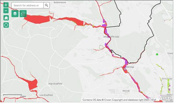
As documented in the Sheffield Strategic Flood Risk Assessment and supporting map layers, NWS31 lies immediately adjacent to the 3b Functional Floodplain and within proximity to a proposed flood storage area designed to protect urban areas downstream (e.g. Neepsend, Kelham Island). Placing new impermeable development next to this zone risks counteracting the strategic flood prevention goal, by increasing local runoff and reducing land available for passive water absorption.
Environment Agency and Defra (e.g. CIRIA SuDS Manual, PPG Flood Risk and Coastal Change) advises that development near functional floodplains (Zone 3b):
- Should be avoided entirely unless essential infrastructure.
- Must demonstrate no increase in downstream flood risk.
- Requires a robust Sequential and Exception Test, and a site-specific Flood Risk Assessment (FRA).
The Sequential Test is unlikely to be passed here given the availability of lower-risk sites in Flood Zone 1 elsewhere in the Sheffield Plan.
Undeveloped vegetated land like NWS31 Absorbs rainwater, slows surface flow, and promotes infiltration as well as reducing flood peaks and protecting downstream communities.
In contrast, housing developments increase impermeable surfaces, accelerating runoff and contribute to flash flooding and drainage system overload.
Replacing natural grassland with rooftops and roads at NWS31 would degrade this natural buffer effect at a critical point in the river catchment.
Furthermore any development at NWS31 would likely require the installation of Sustainable Urban Drainage Systems (SuDS) to manage surface water runoff. Given the site’s sloping topography and proximity to the 3b Functional Floodplain in Tinker Brook, SuDS infrastructure such as attenuation basins, swales, or soakaways will need to be integrated. These features are land-intensive and would significantly reduce the net developable area, further undermining site viability and reducing potential housing numbers—already constrained by heritage, access, and ecological buffers.

